Case Study > GEOG 104 Mt Rainier.Laing;Investigating Glacial Landforms with Google Earth
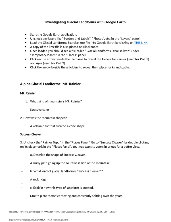
University of Kansas GEOG 104 Mt Rainier.Laing Investigating Glacial Landforms with Google Earth Start the Google Earth application. Uncheck any layers like “Borders and Labels”, “Photos”, etc. in the “Layers” panel. Load the Glacial Landforms Exercise kmz file into Google Earth by clicking on THIS LINK A copy of the kmz file is also placed on Blackboard. ...[Show More]
Preview 1 out of 3 pages
Reviews( 0 )
| Category: | |
| Number of pages: | 3 |
| Language: | English |
| Last updated: | 1 year ago |
| Downloads: | 1 |
| Views: | 0 |


-preview.jpeg)
-preview.jpeg)
-preview.jpeg)

-preview.png)