IntroductionMeasuring a field is a complex and time-consuming task. The sides of a field are usuallymeasured with a measuring tape or chain, and the angles of a field with a compass. Insurveying a field for the purpose of finding its area, the instruments and methods used willbe determined largely by the degree of accuracy required. If it is permissible to have anerror in the area of, say, 0.5 per
...[Show More]
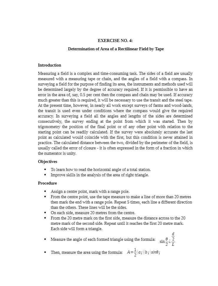
Introduction
Measuring a field is a complex and time-consuming task. The sides of a field are usually
measured with a measuring tape or chain, and the angles of a field with a compass. In
surveying a field for the purpose of finding its area, the instruments and methods used will
be determined largely by the degree of accuracy required. If it is permissible to have an
error in the area of, say, 0.5 per cent then the compass and chain may be used. If accuracy
much greater than this is required, it will be necessary to use the transit and the steel tape.
At the present time, however, in nearly all work except surveys of farms and wood-lands,
the transit is used even under conditions where the compass would give the required
accuracy. In surveying a field all the angles and lengths of the sides are determined
consecutively, the survey ending at the point from which it was started. Then by
trigonometry the position of the final point or of any other point with relation to the
starting point can be readily calculated. If the survey were absolutely accurate the last
point as calculated would coincide with the first, but this condition is never attained in
practice. The calculated distance between the two, divided by the perimeter of the field, is
usually called the error of closure - it is often expressed in the form of a fraction in which
the numerator is unity
[Show Less]


-by-Gary-Donell-SOLUTIONS-MANUAL-preview.jpeg)
-by-Gary-Donell-INSTRUCTOR’S-SOLUTIONS-MANUAL-preview.jpeg)